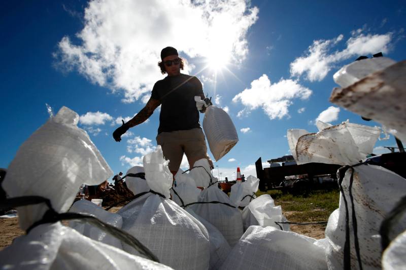
As sea levels continue to rise across the country and around America’s coastal states, the city of Virginia Beach is taking necessary steps to adapt to a changing environment.
Nearly seven years after Hurricane Matthew drenched some areas of the city with 14 inches of rain and damaged roughly 2,000 structures, adding up to about $30 million in damages, city officials are “doing what all local governments should do when it comes to planning for current and future risks,” according to Mary-Carson Stiff, executive director of Wetlands Watch, a nonprofit dedicated to the protection and preservation of wetlands.
Stiff said that Virginia Beach officials were already working to address the specific environmental challenges that the city faced prior to the storm, but Hurricane Matthew was the “real instigator for planned action and coordinated response.”
“Hurricane Matthew just broke everything open, and the city of Virginia Beach in particular had some neighborhoods that were very hard hit because of undersized stormwater systems,” she said. “That was the wake-up call.”
Since that wake-up call, the city–and its residents–have taken several measures to address Virginia Beach’s vulnerability to flooding and its land use generally. Those efforts are meant to both protect the city’s infrastructure and its economy and finances. Recurrent flooding in Virginia Beach costs the city $26 million per year, according to the Virginia Academy of Science, Engineering and Medicine (VASEM).
Here’s a breakdown of some of those efforts:
Rainfall Study and Sea Level Rise Plan
In response to Hurricane Matthew, the city of Virginia Beach examined rain gauge records and observed a pattern of increasing intensity. City officials asked a consulting firm, Dewberry, to conduct a comprehensive study of rainfall patterns in the area. The study confirmed the officials’ observation: the number of intense rainfall events is indeed increasing.
In fact, the study found “a robust, statistically significant increase in heavy rainfall not only in the immediate area but also in the region” and recommended the city increase its rainfall intensity design standards by 20%, or, in other words, to update its flood mitigation equipment and protocols to properly account for the risks of climate change and variability.
Since then, Virginia Beach has implemented its Sea Level Wise Adaptation Strategy, published in March 2020. The strategy “outlines a proactive, long-term approach to enable the City of Virginia Beach to adapt to changing environmental conditions.”
In addition to engaging technical experts, community participants, and regional partners in efforts to address increased rainfall and understand flood risks, the “multi-layered Adaptation Framework” looks at the city’s watersheds and lays out the specific flood drivers and risk types distinct to that watershed and comes up with solutions from there.
The adaptation strategy considers structural alternatives for coastal flood protection, individual building and site-level flood risks, and more. For example, the city is considering the implementation of several different city-wide structural flood protection systems, including surge barriers or gates, and floodwalls and levees.
Surge barriers are designed to only allow water to flow through while conditions are “normal,” or typical of a given area; they are closed when storm surges are forecasted to exceed a specific water level. Floodwalls and levees, on the other hand, are used in locations over land. Levees, or earth embankments, and floodwalls, or concrete or steel walls, are constructed along the banks of bodies or water so that floodwaters can’t reach the area behind it.
Stiff said that “understanding that risks are different in different parts of the city,” is essential to protecting Virginia Beach. Understanding these different risks is the first step in knowing what flood mitigation efforts are correct in which parts of the city.
Storm Bond Referendum and the Bow Creek Stormwater Park
In 2021, Virginia Beach residents approved a referendum that allowed the city to issue up to $567 million in bonds to cover the cost of accelerating a flood protection program designed to address stormwater and sea level rise.
In approving the measure, residents agreed to an increase in their property taxes in order to fund the bonds. Depending on the terms of the bonds issued, the city estimated that real estate rates would rise between 4.3 and 6.4 cents per $100 of assessed value.
One of the projects funded by the bond is already underway: construction of the Bow Creek Stormwater Park.
The city broke ground on the massive project last month, following the lead of cities across the country who have implemented the flood prevention infrastructure in the last several years.
Stormwater parks are recreational spaces that are designed to flood during extreme events and to withstand flooding, according to the Federal Emergency Management Agency (FEMA). By storing and treating these floodwaters, stormwater parks reduce flooding elsewhere and help improve the overall water quality of an area.
The stormwater park is being built on the site of the former Bow Creek Golf Course, which shut down in Nov. 2022.
Instead of just digging a hole to capture stormwater in the area that was once a golf course, Virginia Beach’s public works and parks and recreation departments decided to collaborate. In addition to being able to store 300-acre feet of water, the Bow Creek Stormwater Park will, once completed, feature nature trails, pickleball courts, wildlife viewing shelters, mountain bike trails, and more.
The city’s planning, design, and development administrator Chad Morris told The Virginian-Pilot last month that once the Bow Creek Stormwater Park is fully operational, its usage will rival that of “Mount Trashmore,” Virginia Beach’s–and the nation’s–first landfill park.
In the 50 years since it was created, Mount Trashmore has become a popular spot for working out, walking pets, and numerous public events, including the annual summer carnival. It’s part of Virginia Beach’s vast 33,640 acres of parkland, which make the city millions of dollars per year.
Like Mount Trashmore Park, the Bow Creek Stormwater Park will serve as another structure where Virginia Beach families can spend time together, while also helping to reduce water usage and flooding.
“The way that the city has repurposed large open spaces that were used for recreation, like a golf course, is so smart,” Stiff said. “It’s a really smart and innovative way to address their stormwater concerns and not have to demolish structures.”
Marsh Terrace Project
In the aftermath of Hurricane Matthew, Virginia Beach is also working on the Marsh Restoration in Back Bay.
The city is leading an effort to design and permit march terraces—artificial flat strips of land that are built in wetlands to prevent erosion—within Bonney Cove, located in the Back Bay National Wildlife Refuge. According to the city, the project will “restore valuable habitat for Back Bay fish and wildlife species, improve water quality, and reduce flood impacts by reducing wave heights and water velocities.”
The project site was selected because it offers the opportunity to restore approximately 260 acres of marsh island habitat that has “resulted in the opening of a secondary channel”; this is a problem, the city notes, because that channel allows an increased flow of water to areas with high population density.
Without intervention, floodwaters will continue to flow through this channel, at increasing intensity as the years go on, and will thus continue to increase wave heights into the north end of the bay, leading to more flooding in Virginia Beach communities. This will in turn cause significant damage to the area and infrastructure, disrupt public transportation, and have a negative effect on the local economy, according to an article published in Water Economics and Policy last year.
This article also found that flooding takes the largest toll on small businesses. For a city like Virginia Beach, which is home to 37% of the small businesses in the state of Virginia as of May, flooding has an even greater effect.
“The city of Virginia Beach is thinking outside of the box through the way that they’re managing land and they are increasing design standards to reflect current conditions,” Stiff said. “We’re not seeing that in every community.”
Freeboard Requirement
In recent years, the city of Virginia Beach has also instituted a freeboard requirement; freeboard is the act of elevating a building’s lowest floor above predicted flood elevations by a small, additional height, according to FEMA.
The city’s freeboard requirement states that all new or improved residential buildings located within a Special Flood Hazard Area (SFHA), or an area where the National Flood Insurance Program’s (NFIP’s) floodplain management regulations must be enforced, must be elevated so the lowest floor is above the base flood elevation indicated on the Flood Insurance Rate Map.
As Wetlands Watch says, adding freeboard “provides significant protection against flood damages caused by sea level rise.” Plus, as FEMA notes, “freeboard results in significantly lower flood insurance rates due to lower flood risk.”
So not only does adding freeboard protect the Virginia Beach community, it also puts money back in their pockets.
“Stringent freeboard requirements ensure that new development can accommodate storm surge both in the present and in future conditions,” the organization states.
Pushing Back on Potentially Harmful Projects
The city of Virginia Beach is also pushing back against certain projects that threaten the area’s wetlands.
Last month, the Virginia Beach Planning Commission held a meeting to discuss the potential development of land owned by Wycliffe Presbyterian Church in Great Neck.
Church leaders requested to reduce the boundary of their church’s property from 8 acres to 3.4 acres; the land not being used by the church would then be recognized as “residential,” making it possible for the church to later sell the property.
The problem, according to those who oppose the church’s ask, is that there is a lake on the church property called “Lake Conrad.”
Virginia Beach resident Windy Crutchfield created a petition against the development. She told WTKR that those against the project “don’t object to the church trying to sell its asset.” The problem, she says, is that it’s “never been a part of the city’s plan to build on wetlands.”
“We don’t believe any wetlands should be filled in so someone can create more land to build houses,” she said.
This is a sentiment Stiff echoed, although Wetlands Watch hasn’t released an official statement on the development yet.
“It is never a good idea to fill in wetlands,” she said. “Any kind of mitigation of an existing, healthy wetland is going to be an underperformance of that existing wetland.”
Now, the decision is left to the Virginia Beach City Council, which is expected to vote on the issue as early as this month.
Moving Forward
The state also has a role to play in preparing Virginia Beach for future floods and making the city’s infrastructure more flood-resilient.
Gov. Glenn Youngkin this month signed the state’s budget agreement, which includes $10 million for a new project designed to promote redevelopment and curb flooding near the Virginia Beach Oceanfront.The 17th Street Regional Stormwater Management Facility will be built across the street from the Virginia Beach Sports Center.
The project will include a new pond to collect rainwater. Then, bacteria, nutrients, and sediment will be removed from the water at the facility before its discharged into the Rudee Inlet Watershed, a highly populated area of the city which includes homes, resort hotels, restaurants, and a military base.
Democratic state Sen. Aaron Rouse also called attention to the $7 million the budget allocated for “stormwater encroachment resilience activities” and natural space preservation in the Southern Rivers Watershed and Chowan River Basin.
“Virginia Beach is among the most vulnerable communities in the nation to the impacts of climate change,” Rouse said, highlighting the importance of these funds.
This money, however, will not be provided until fiscal year 2024.